
Design your stages
THE FRENCH WAY OF SANTIAGO THROUGH ARAGON. . DISCOVER THE MAJESTY OF THE PYRENEES. LET YOURSELF BE CARRIED AWAY BY THE STORIES OF A ROAD
Listen. The sound of footsteps in time. Since the 9th century. Time after time. Open your eyes and feel yourself accompanied by knights, monks and witches. Look upwards. Discover the majesty of the Pyrenees. Let yourself be carried away by the stories of a road, the first European road, and by a river with the name of a small nation, Aragon.
Breathe. Stand up and say hello: -ultreia-.
You are welcome to the Way of Saint James in Aragon. The French Way. The Tolosan Way. Mythical names in ancient books. Places with magic for your journey: Summus Portus, Canfranc, Cueva de las Güixas, Jaca, San Juan de la Peña, Santa Cruz de la Serós, Puente la Reina, Artieda, Martes, Mianos, Ruesta, Undués de Lerda…
Although the route is usually proposed in four stages, with the new approach proposed for the Directive of Territorial Planning of the Camino de Santiago – French Route as it passes through Aragon, each of the points and places of the route are highlighted, so that each pilgrim, traveller or visitor can plan their routes and stays according to their tastes and time availability.
The route is as follows (walking times are given as a guide and are approximate):
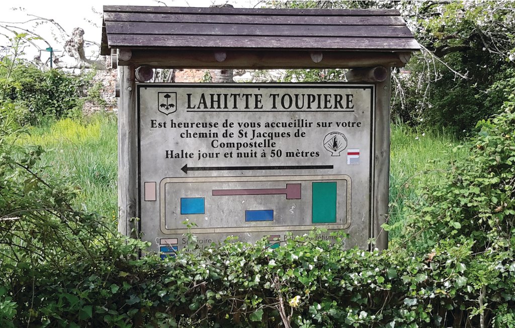
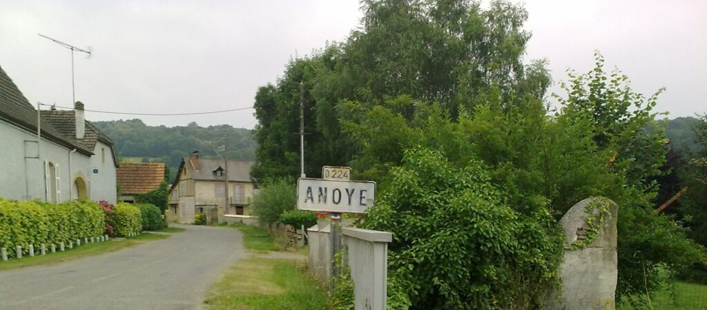
Lahitte-Toupiére to Anoye
- Distance: 18.3 km
- Duration: 4h40
GR 653 From Oloron to Bedous.
Don’t be in a hurry to leave Oloron, the old and beautiful capital of the Haut-Béarn.
If the landscapes covered by this stage show a certain continuity, combining agricultural valleys and wooded hills, this section of the Chemin d’Arles is half Bigourdan, half Bearn, since it leaves the Hautes-Pyrénées department to enter the Pyrénées-Atlantiques. The entrance to Béarn is marked by a beautiful view of the Pyrenees.
Distance : 18.3 km
Difference in altitude : 300 m
Duration : 4h40 (on foot)
Difficulty: Medium
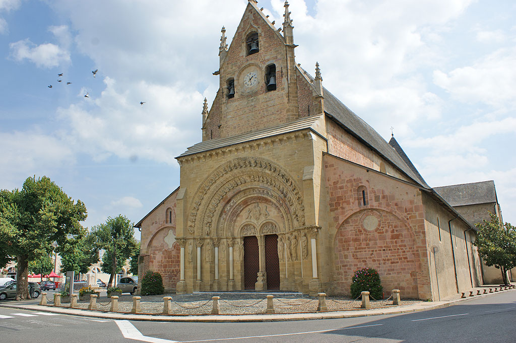
Anoye to Morlaas
- Distance: 15 km
- Duration: 3h45
GR 653 From Anoye to Morlaàs.
A centuries-old stage in Morlaas, once the capital of Bearn, known for the sculpted portal of its Sainte-Foy church.
Today, the route approaches the town of Pau, crossing in turn the agricultural plateau and open moorland. A scattering of villages, on the heights of the Lées and Gabas rivers, precedes the small town of Morlaàs, the last stop before walking into the Gave de Pau valley. An age-old pilgrimage stop, once the capital of Béarn, known for the sculpted portal of its Sainte-Foy church.
Distance : 15 km
Difference in altitude: 200 m
Duration: 3h45 (on foot)
Difficulty: Medium
Morlaàs to Lescar
- Distance: 19.7 km
- Duration: 5h10
GR 653 From Morlaàs to Lescar.
This stage links two masterpieces of Romanesque art, the church of Sainte-Foy in Morlaàs to the cathedral of Notre-Dame in Lescar, and also boasts a very interesting natural heritage.
If this stage links two masterpieces of Romanesque art, the church of Sainte-Foy de Morlaàs to the cathedral of Notre-Dame de Lescar, it also boasts a very interesting natural heritage despite its proximity to the city of Pau. The view of the Pyrenees is omnipresent on a clear day, and you can discover the Bastard forest, the green lung of the Lande du Pont Long, walked by thousands of walkers, pilgrims and shepherds.
Distance: 19.7 km
Difference in altitude: 45 m
Duration: 5h10 (on foot)
Difficulty: Medium
Lescar to Lacommande
- Distance: 13.5 km
- Duration: 3h30
GR 653 From Lescar to Lacommande.
The itinerary crosses the hills of the Jurançon region, finding a secular stopover at Lacommande, before joining the Aspe valley on the Oloron-Sainte-Marie side.
The view from the Place Royale in Lescar is a natural invitation to head south, cross the Gave de Pau valley and get closer to the imposing Pyrenean mountain range. The itinerary therefore leaves the town of Lescar and crosses the hills of the Jurançon region, finding a secular stopover at Lacommande, before joining the Aspe valley on the side of Oloron-Sainte-Marie.
Distance : 13.5 km
Difference in altitude: 155 m
Duration: 3h30 (on foot)
Difficulty: Medium
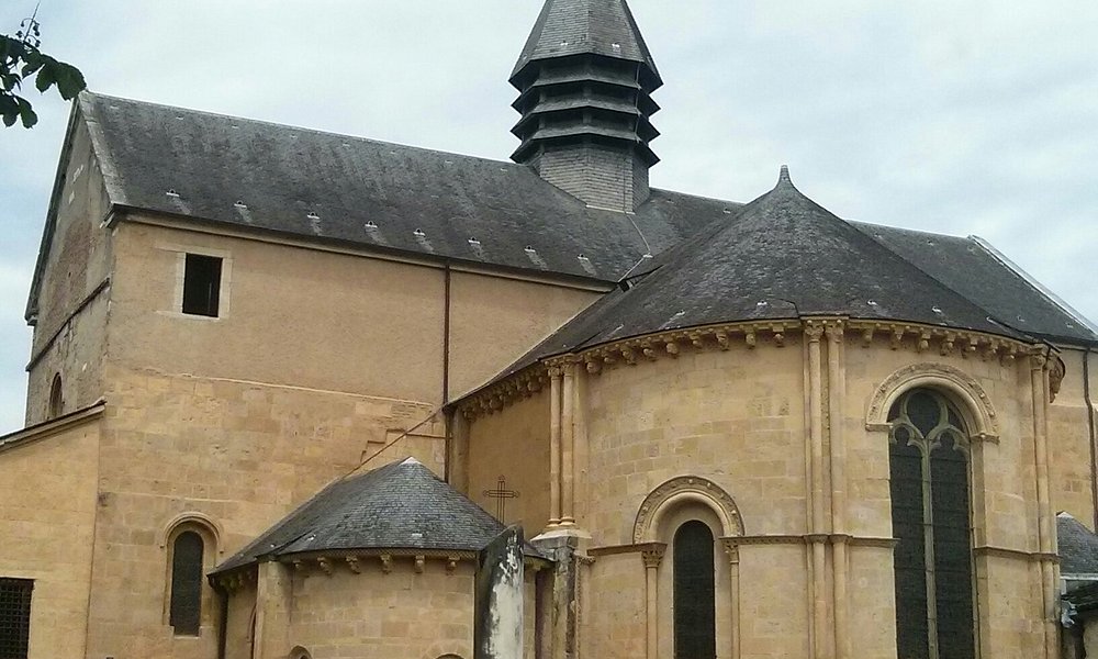
Lacommande to Oloron-Sainte-Marie
- Distance: 18 km
- Duration: 5h
GR 653 from Lacommande to Oloron-Sainte-Marie.
The old commandery ensured the safety of the Compostela pilgrims on the way to Arles.
The old commandery ensured the safety of the Compostela pilgrims on the way to Arles. The Laring wood, through which the GR 653 passes, is no longer infested with wolves or brigands. From the heights of Estialescq, the Pyrenean mountain range stands out on a clear day.
Distance : 18 km
Difference in altitude: 670 m
Duration : 5h (on foot)
Difficulty:Difficult
Oloron-Sainte-Marie to Bedous
- Distance: 30 km
- Duration: 1 day
GR 653 From Oloron to Bedous
Don’t be in a hurry to leave Oloron, the old and beautiful capital of the Haut-Béarn.
Don’t be in a hurry to leave Oloron, the old and beautiful capital of the Haut-Béarn. But when you finally do, from the top of Sainte-Croix, you will face the indentation that the Gave d’Aspe has carved in the Pyrenean wall. This is precisely the path that you will take. Beforehand, it will have wandered through the countryside. Then suddenly you enter a deep, intimate gorge, barely interrupted at the level of Sarrance, a high place of Christianity as much as of the ancient Pyrenean religion… It opens up, just as suddenly, into the immense breath of air that is the Bedous plain in these reliefs.
Distance : 30 km
Difference in altitude: 393 m
Duration: 1 day (on foot)
Difficulty :Medium
Bedous to Borce
- Distance: 13.8 km
- Duration: 3h30
GR 653 from Bedous to Borce.
Between the two agricultural centres of Bedous and Borce-Etsaut, flooded with light, stretches a defile where the sun, the road, the river and the railway struggle to find a way through.
This section of the route runs for the most part along the Gave d’Aspe and through numerous wooded areas, bringing calm and freshness. However, beware of the lorries on the RN 134, an international road, which you will have to use on three short sections.
Distance : 13.8 km
Difference in altitude: 560 m
Duration: 3h30 (on foot)
Difficulty: Difficult
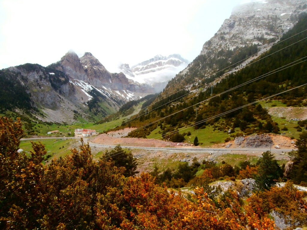
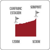
Borce to Col du Somport
- Distance: 17 km
- Duration: 6h30
GR 653 From Borce to Somport.
After Borce, the altitude rises rapidly. Soon the last houses and barns fade away.
This section of the Saint-Jacques is a big climbing stage in the crossing of the Pyrenees. The villages of Borce, Etsaut and Urdos will allow you to refuel or eat before crossing the border.
Distance : 17 km
Difference in altitude: 1380 m
Duration: 6h30 (on foot)
Difficulty: Difficult
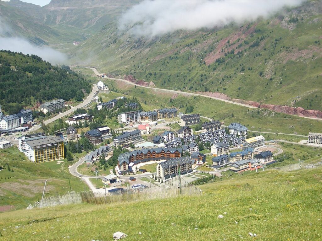
Somport - Candanchú
- Distance: 1.5 km
- Duration: 30 minutes
From Somport you descend gently through the mountains. The Aragón river, habitat of otters, trout, kingfishers, blackbirds and grey herons, will mark the script of this section of the route. To your left, the Raca and Collarada, to your right the peak of Aspe. You follow the GR 65.3. Orchids and lilies accompany you. Cows, sheep and horses. Eagles and marmots. Vultures and buckaroos. Life meets you.
The kings of Aragon built bridges, shelters, inns and hospitals or baths along this path. Churches, hermitages and crosses protected the lands, their people and the walkers.
Just at the beginning, 800 metres further on, the hospital of Santa Cristina, located in this place since the 11th century. It tells us stories of pilgrims and medieval cultures, all with capital letters. But it also tells us about hospitality. It was one of the three main ones in the world, along with Rome and Jerusalem. If the 13th and 14th centuries marked its heyday, religious wars, closed borders and other calamities put an end to it in the 19th century.
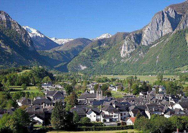
We are approaching Candanchú. Alpine orogenesis, erosion, the river and the ravines shape the landscape and its people before us.
The ski resort, with one hundred skiable kilometres, is combined with the remains of its castle. Del Castellar.
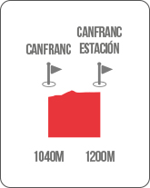
Candanchú - Canfranc
- Distance: 7 km
- Duration: 1h45 minutes
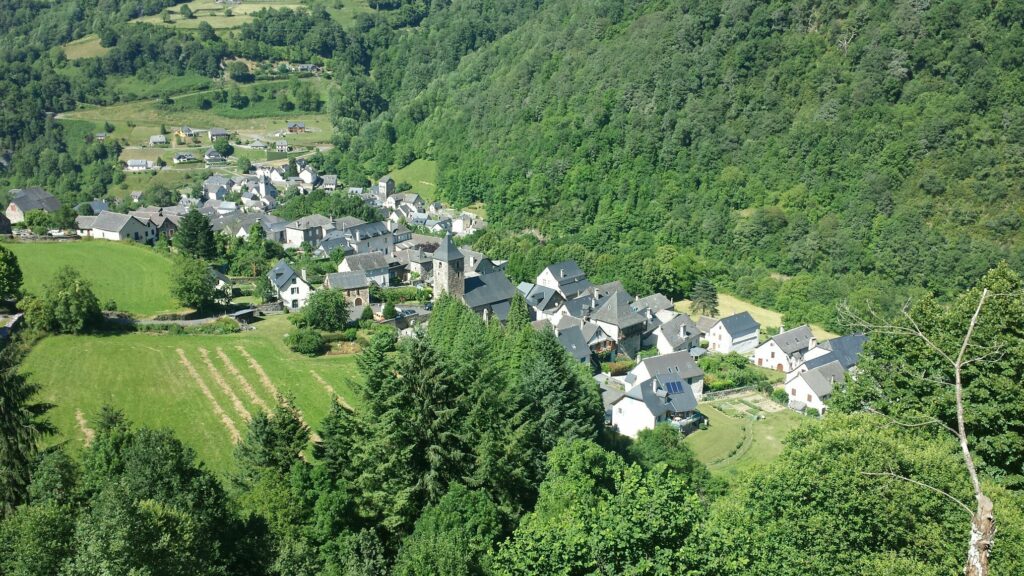
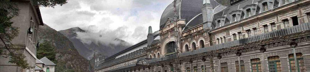
We cross the Ruso bridge and head for Canfranc. After passing the N-330 road and the Rioseta ravine, following the river, along a steep path and through forests, we will think of stories of the Coll de ladrones. Castles, defensive lines or rifle forts, bunkers between Canfranc and Villanúa will be a constant feature of this stretch of the route. This is what the border is like. We arrive at Canfranc Estación (Plaza de los Arañones). From the Roldán Bridge we can choose between two routes. Towards the village or along the more traditional route. Both will join up again at the Secrás Bridge.
The main church of Canfranc is by Miguel Fisac but the emblem is its railway station. It is something more. History, legend and emotion. Aragonese heritage in capital letters.
Canfranc Estación - Canfranc Pueblo
- Distance: 3.5 km
- Duration: 1h
After crossing the road and a tunnel we descend towards the Aragón riverbed. We are approaching Canfranc village. We will find a viewpoint to the strong fusilier and we will cross a beautiful path covered with beech trees. In Canfranc pueblo we enter by the Puente de Arriba bridge. The Campo de los Francos, a town that was born for the road. Its inhabitants were in charge of maintaining and looking after it in exchange for being exempt from paying taxes and forgetting their debts with the justice system. We leave this village-street by the Puente de Abajo, one of the images of the route.
Canfranc Pueblo - Villanúa
- Distance: 4.5 km
- Duration: 1h15
We head towards Villa Nueva, or Villanúa. Along the old road, to the left of the N-330. Dolmens, guixas caves or starry witches’ witches’ covens will appear in your path. The most telluric path speaks to us. Fountains, watering places, deer bellowing or mushrooms will be our landscape.

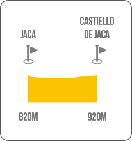
Villanúa - Castiello de Jaca
- Distance: 7 km
- Duration: 1h45
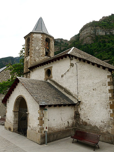
At the exit of Villanúa, Romanesque bridge and again, two paths, right and left of the Aragón river. The right-hand side takes us to Aruej, one of the must-visits on the Castiello route. The left-hand branch crosses the old quarter to reach Castiello de Jaca or the hermitage of Iguácel via the Orbil path and continue towards Jaca. It is a quiet route with pleasant shady stretches. We arrive at Castiello de Jaca via the church. Romanesque. Dedicated to San Miguel. Also known as the church of the Hundred Relics (a name with a mysterious history to discover on your visit).

Extension from Castiello de Jaca to Santa María de Iguacel and San Adrián de Sasabe
It is worth the detour to visit the old valley of the onions. About 12 km one way and the same number of kilometres back. The Garcipollera valley opens its doors to us. We reach it from Castiello de Jaca. Riverside vegetation, oaks, hazelnut trees with blackberries and boxwood form a spectacular path. Nature has come back to its own. Playful squirrels, sarrios, eagles and birds of prey observe us from their vantage points.
Sentimental depopulated areas such as Yosa, Bergosa, Larosa and Acín combine with the future such as Bescos or Villanovilla. The river Ijuez accompanies us. About five kilometres from the new town, Villanovilla, Santa María de Iguacel appears to us as if it had emerged from another era. A real treasure chest and treasure of the valley, an ancient monastery converted into a hermitage today. Indispensable.
SAINT ADRIÁN DE SASABE
After leaving Villanúa. At Villajuanita, we leave the road to Santiago for a moment to take the road to Aratores. This is a small town perched on a hill that leads us to Borau. Charming village with well cared for popular architecture. An ideal place for extreme sports and after going up the river Lubierre we reach San Adrian de Sasabe.
Episcopal see. A place that housed the Holy Grail within its walls. Romanesque in style with influences from the Lombard world and, of course, from the world of Jaques, it was founded in the 11th century. Another good reason to get to know the life around the route.
Castiello de Jaca - Jaca
- Distance: 6.5 km
- Duration: 1h45
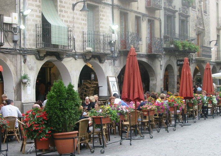
We leave the Casadioses fountain behind us, next to the washing place, and we can already sense the capital of the old kingdom. We cross the Aragón and Ijuez rivers. We walk through the cabañera. Like the shepherds who used to move from the mountains to the plains. We pass Torrijo. Finally, Jaca. Jaca, jacobea…you play with words.
The hermitage of San Cristóbal, which helps walkers, welcomes us. You are entering the place where a thousand-year-old country was born, as a county in the Carolingian era around 800. Jaca was the first capital of the Kingdom of Aragon and the first city on the Camino de Santiago.
We continue walking towards the place where the Salud elm tree used to stand. Today it has disappeared. A cross and the hospital of San Marcos show us which way the route goes. If we take the latter direction, walking straight ahead, we can enjoy the city. A path of metal shells indicates the route.
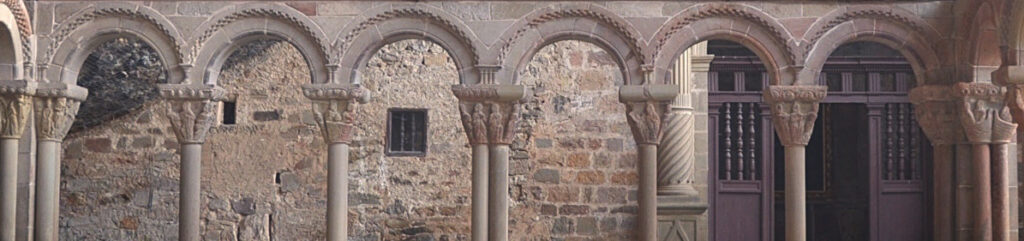
St. Peter’s Cathedral is impressive. The Middle Ages speak to you. The legend of Santa Orosia illuminates from one of the chapels. Chrysmons, Jaquesan chesswork, corbels, tympanums, barrel vaults… the road to Santiago since the 11th century sends you a message in stone.
Strolling along the Calle Mayor, visiting the star-shaped citadel, the Plaza de la Cadena with the statue of the first king of Aragon, Ramiro I, flanked by the Torre del Reloj or the Torre de la Cárcel or the Torre del Merino, as it is called, or going to the church of Santiago or the church of the Dominicans are good alternatives. Oroel keeps us safe. There are several hostels in the city and good hostelry.
Jaca is a good place to taste the stewed big game with good wine, the pickled small game and the sweets, the crespillos: borage in batter with sugar, chilindrones and almendrados, calderetas, lamb… your mouth will water. And it won’t be a miracle. You will carry the smell of thyme in your memory.
Extension of San Juan de la Peña and Santa Cruz de la Serós
As soon as we leave Jaca we can take a detour, crossing the river Gas and without reaching the road to Atarés, towards the monastery of San Juan de la Peña. The route is difficult. But you can’t miss it. With every step you take, you will get closer and closer to the heart of Aragon. It is the GR 65.3.2. As if it were a secret key that you have to follow to reach the Middle Ages.
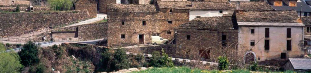
Atarés is a pretty village, oozing with popular architecture on all four sides. Masonry, slab roofs, Pyrenean chimneys that remind us of stories of scarecrows.
The parish church is dedicated to St. Julian and there is a fountain with crystal clear water. After leaving the village, climb up the Atarés ravine. Holm oaks, oaks and boxwoods flank you on your way and if you are lucky, roe deer and birds of prey will come your way. You will have a star.
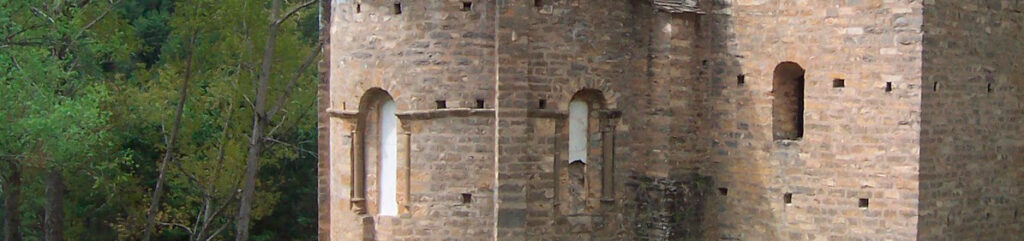
You will reach the plain of San Indalecio, who is said to have been a companion of Santiago himself, and you will see the new Baroque monastery of San Juan de la Peña. The Interpretation Centre of the Kingdom of Aragon is an essential visit. You will walk down to the Old Monastery of San Juan de la Peña. No less than Sancho el Mayor of Navarre, back in the 10th century, began to build it.
It will not leave you indifferent. The Council Hall, the monks’ dormitory, the church of San Julián and Santa Basilisa, the new church, dating from the 11th century and dedicated to San Juan, kitchens, ovens and above all: the necropolis of the kings of Aragon. Ramiro I, Sancho Ramirez and Pedro I chose San Juan de la Peña as their royal pantheon. And the surrounding area is no exception. Nature and architecture. A wild space. Common vultures fly over your head. A living legend.
They say that San Voto was hunting deer on Mount Pano. He fell down the precipice of a ravine and entrusted himself to Saint John the Baptist. The horse miraculously descended gently to the ground. There he found the cave-hermitage dedicated to St. John. And inside, the corpse of a hermit, Juan de Atarés. He sold everything. He returned to the place with his brother Felix and they became hermits. The legendary monastery of San Juan de la Peña was born.
The Romanesque cloister deserves special mention. We could say cave cloister, as its vault is the cave that frames the monastery. The repertoire is linked to the creation of Eve, the temptation of Adam, the expulsion from Paradise, Saint John the Baptist and the infancy of Christ. Pure Way of St. James. Romanesque with capital letters. Both in form and content. You are going to tell it.
One last secret. The Grail of the Arthurian legends, the Christian chalice of the Last Supper, was in this monastery. Its custodians, the kings of Aragon. The power of miracles or the miracles of power.
We leave San Juan de la Peña behind us and continue descending towards Santa Cruz de la Serós. The Sores, the nuns, were the inhabitants of its church-monastery. More unknown, more surprising. Chrysmons, impossible architecture, spaces and stories of the daughters of King Ramiro to be discovered.
Its surroundings are equally spectacular. Stone architecture. Espantabrujas and the hermitage of San Caprasio with its arches bidding you farewell when you leave for Santa Cilia de Jaca.
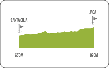
Jaca - Santa Cilia
- Distance: 15.5 km
- Duration: 4h
We leave Jaca in the direction of Navarre. We are going to cross the Canal de Berdún. We must reach the N-240. We will leave near the cemetery. We go in the direction of the old slaughterhouse and the hermitage of La Victoria. There, the first Friday in May is a big festival for the people of Jacetán.
We continue along the road, go down to the Aragón river, cross the Gas river and arrive at Casa Municionero, from here we have the option of taking a detour to visit two essential places: San Juan de la Peña and Santa Cruz de la Serós.
If we continue along the main road we arrive at the military camp of Batiellas, a grove of gall oaks provides shade and after passing the Venta de Esculabolsas, we arrive at Santa Cilia, where the road from Santa Cruz de la Serós via Binacua comes together.
Throughout La Canal de Berdún, it is easy to see falcons, kestrels and kestrels in the crags. It is the natural communication route to Navarre. The old Roman road that linked Jaca with Pamplona ran through these same places. The landscape is flatter and with cereal fields, in sharp contrast to the mountain we have left behind. Red kites will be watching you from above.
Santa Cilia - Puente de la Reina de Jaca
- Distance: 7 km
- Duration: 1h45
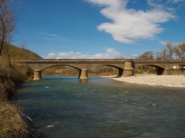
From Santa Cilia or Santa Cecilia (Santa Zilia, in Aragonese) we take a path towards the N-240. There a path leads us to Puente la Reina. Before arriving we descend again towards the river Aragón. Puente La Reina could have been the legendary Astorito, the summer resort of the kings and queens of Aragon.
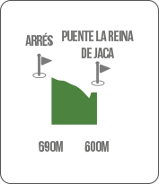
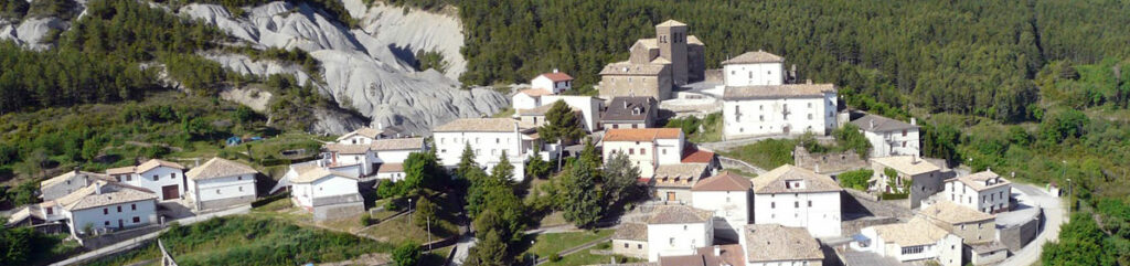
Puente la Reina de Jaca - Arrés
- Distance: 5.5 km
- Duration: 1h30
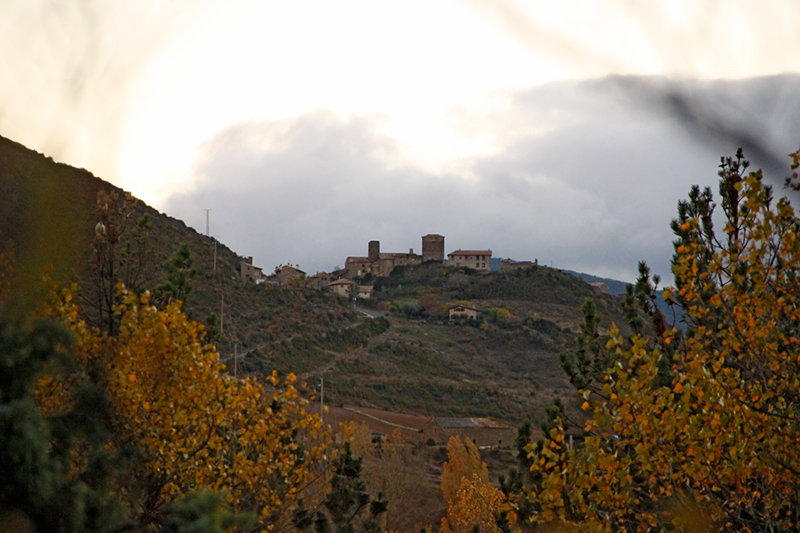
From the bridge at the entrance to the town, without passing it, we head towards the road to Arrés. We soon leave it to climb to the top, along a bridle path. Arrés is a medieval village and a natural viewpoint overlooking the Canal. It is worth enjoying its mill and popular architecture.
Arrés - Martes
- Distance: 7.2 km
- Duration: 2h
Descending from Arrés we head towards the road to Martes. As we advance, the landscape begins to fill with holm oaks and crops of great scenic interest. Near the cereal fields we can see wheat fields or calanders.
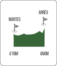
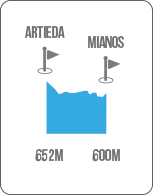
Martes - Mianos
- Distance: 6.4 km
- Duration: 1h45
We advance towards Venta de Mianos. The geological formations, the Pyrenees, the contrast between the crops on the plain and the mountains and the medieval settlements and depopulated areas accompany us on this stretch.

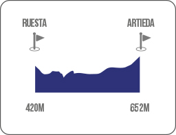
Mianos - Artieda
- Distance: 4.5 km
- Duration: 1h15
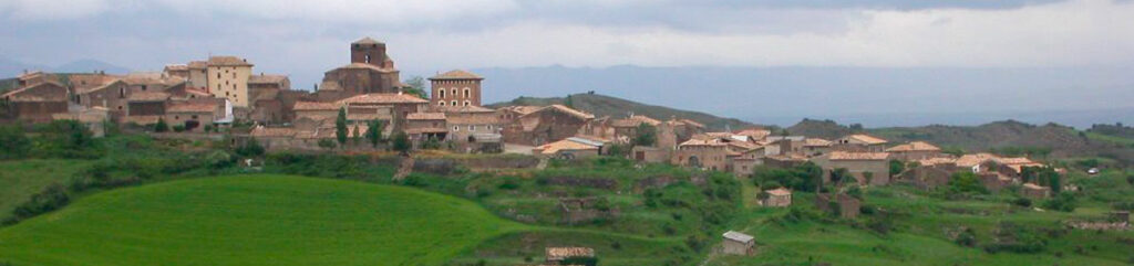
After passing the Venta and heading towards the corral of Peronero, we ascend to Artieda, its interesting medieval centre and its outstanding church of San Martín.
Artieda - Ruesta
- Distance: 6.5 km
- Duration: 1h45
From Artieda by local road and then by road, we will walk towards Ruesta, bordering the Yesa reservoir.
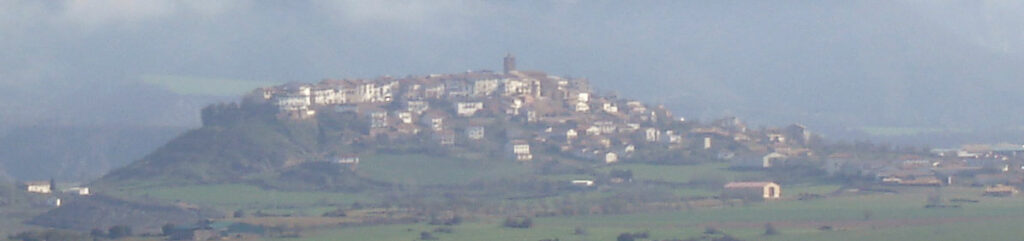
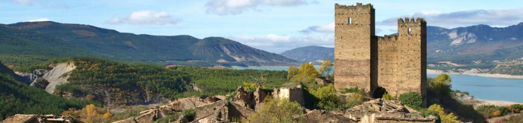
Ruesta. A medieval town, towers, castles, a church dedicated to the saint of the medieval poor: San Martín de Tours, hermitages… A superb display that crowns its Muslim fortress. The big combines with the small. The hermitages of San Juan Bautista and Santiago are the Romanesque and Christian counterpoint of the route. The bottom of the reservoir is a reminder of what used to be its lands and fields. Pain, silence and nostalgia contrasted with the current beauty of the town.
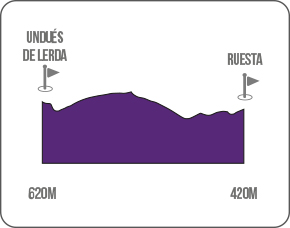
Ruesta - Undués de Lerda
- Distance: 11.3 km
- Duration: 3h
After leaving the hermitage of Santiago behind us, we will ascend from here along a forest path and pine groves towards Undués de Lerda. The path will become cobbled. You are on the old road, probably Roman, which in the Middle Ages served as the road to Santiago de Compostela.
We reach Undués. A little further on we leave the lands of Aragon to enter the ancient kingdom of Navarre. Santiago is a little closer. -Ultreia.