

Landscape
The Way of St. James crosses the Pyrenees and one of the branches of the so-called French Way, the Toulouse Way
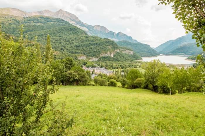
Enters our country through the Somport pass, at an altitude of 1,649m. Its route through Aragon runs along the Aragon valley from its headwaters to its entry into Navarre, at the height of the Yesa reservoir.
The Jacetania is structured by the Aragón river and its main Aragonese tributaries: Lubierre, Estarrún, Aragón Subordán, Veral and the lower course of the Esca. Between the Yesa reservoir and the source of the Aragón river there is barely 50 km in a straight line, but its altitude difference is 2,300 m with a climatic gradient that ranges from 730 l of annual rainfall and an average temperature of 12º C in Artieda (650 m) to almost 2,000 l and 5.2º in Candanchú (1,600 m). Temperatures are even lower on the Pyrenean peaks. These differences in temperature and rainfall explain the varied mosaic of vegetation in the Jacetania region.
The Jacetania region
The landscape maps of Aragon describe and evaluate the natural landscapes of the region, providing relevant information for territorial knowledge and management. Methodologically, they are developed on the basis of the definition of homogeneous units from a landscape point of view (the “landscape units”) and the large landscape domains.
Since the landscape is dynamic, they study not only the negative actions or impacts and the positive elements that shape it, but also the medium and long-term trends that dominate it. In this way it is possible both to define its intrinsic qualities and to assess its quality, fragility and suitability for different uses, also establishing planning and management proposals.
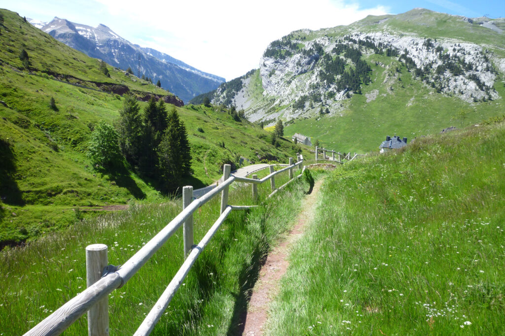
The methodology for its elaboration also includes the assessment made by residents and visitors of the landscapes of their region, and the proposal of a series of routes by road and on foot to discover the variety of its landscapes.
The Pilgrims’ Route to Santiago de Compostela runs for the most part through the region of La Jacetania in Aragon, from its entrance in France to near Navarre, where it crosses the Cinco Villas region, and is in itself an element of heritage and landscape value recognised in the landscape maps, where it becomes an agent that adds quality to the landscapes through which it passes.
From a landscape point of view and based on the information obtained from the landscape maps of both regions, the most relevant data are as follows:
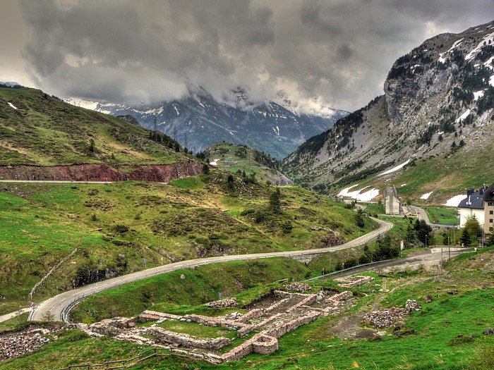
At its entry into Aragon and along the valley almost until it reaches Jaca, the route runs entirely along the Aragon glacial trough, crossing landscape units of the highest quality in the region and in Aragon (values of 8 and 9 out of 10 until reaching Villanúa, which are 5 in the area around Jaca). These are high mountain landscapes with a narrow valley floor populated by forests dominated by limestone ridges and where in the north-eastern sector there are also metamorphic materials. Along this stretch of the route you can enjoy some spectacular scenery next to the river.
Landscape and Heritage
In this already attractive scenery, where the seasons of the year provide an incredible variety of colours (snow in winter, greenery in spring and summer and a spectacle of autumn colour in its mixed deciduous and evergreen forests), the Pilgrims’ Route to Santiago contributes to increasing this quality with unique elements that are recorded and valued in the landscape maps: Santa Cristina hospital and the pilgrims’ bridge in Canfranc, the hermitage of San Vicente in Aruej, and other heritage elements of great value among which the international railway station of Canfranc stands out. Alongside these, pilgrims will find the Fusileros turret and the church of La Asunción in Canfranc, and the dolmen and the cave of Las Guixas in Villanúa.
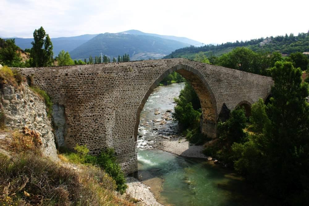
Towards Jaca, the road and the river gradually lose the energy of the relief, first entering the domains of the Flysch and then expanding into a wide valley floor. In this section, the quality of the landscape diminishes momentarily in the area around Jaca, due both to its intrinsic characteristics and to the greater imprint of human activities, but it recovers again downstream: in the section up to Puente la Reina de Jaca, the River Aragón is in a good natural state and has a notable landscape quality, with a score of 6-7 points. As a heritage element, the San Miguel bridge in the area around Jaca is worth mentioning in this section.
From here, the route moves away from the river, entering the domain of the conglomerate and sandstone mountain ranges, in landscape units of medium value (4), and ends its route through La Jacetania. The mill of Arrés is one of the most important heritage elements along this stretch.
The route then enters the Cinco Villas, in the domain of the sandstone, shale and marl mountain ranges, separating it from the Aragón valley. Here the quality of the landscape increases again, with outstanding values (9-8) and with specific elements of great value, such as the Romanesque hermitage of San Juan Bautista, or the villages of Ruesta and Undués, from where it heads towards Navarre through landscape units of notable quality (7-6).